Walk: Wessenden and Black Hill on the old and new Pennine Way routes
Important note: This is a challenging walk across open moorland, and only recommended for experienced walkers. Even in good visibility, it needs careful navigation skills with a map and compass.
Ticking off Peak District Ethels in some of the lesser known parts of the Peak District National Park last winter fired our enthusiasm for more exploration. So, one cold, frosty, winter morning, we looked at the OL1 map and decided to do a walk combining the old and current Pennine Way routes. It was 9.5 miles and, with a later start than planned, we knew it would mean walking back in the dark.
We decided to make an adventure out of the day and packed the stove so we could enjoy piping hot cuppas on our breaks. The plan was to make it to Black Hill summit by sunset, meaning the final section in the dark would be on a well-made path that we knew well.
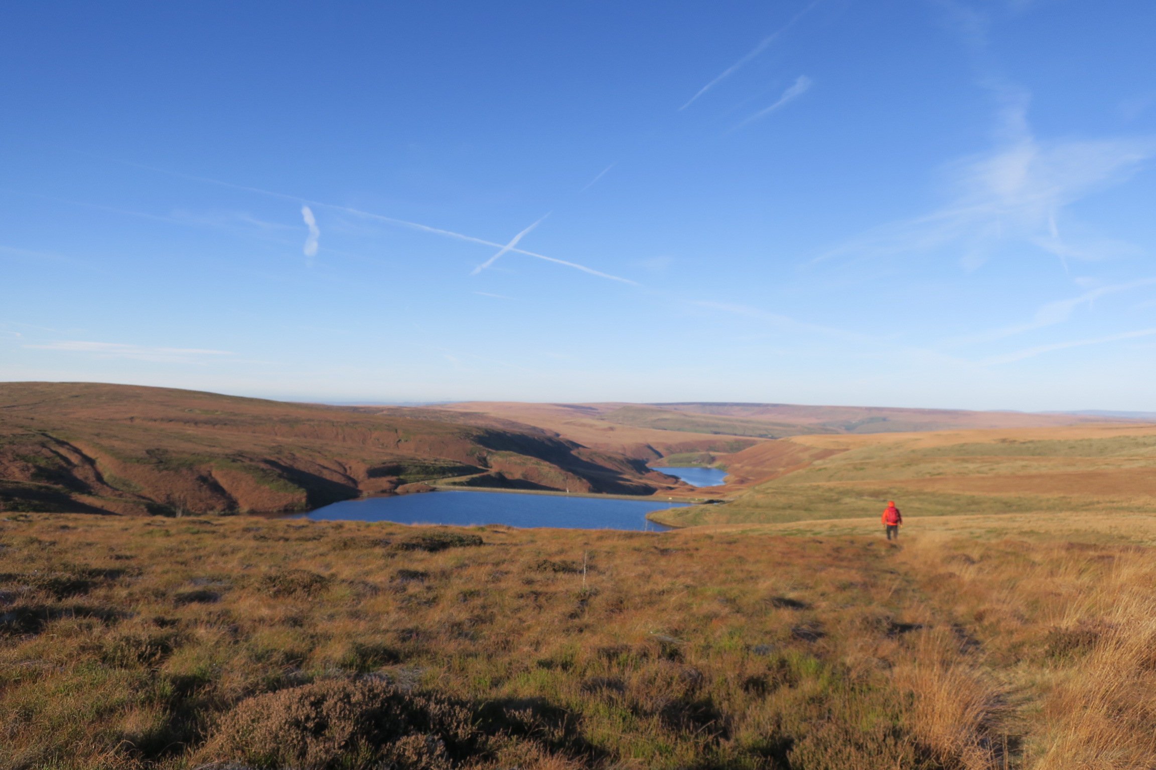
Following the current Pennine Way to Black Moss reservoir
Parking on the A635 (Holmfirth to Greenfield road) near the popular Snoopy’s snack van, we headed down the Wessenden Valley.
We chose to take direct route across the moors to meet the Pennine Way. But, it was a boggy section and simply cuts off a corner. I think I’d just choose to walk on the Pennine Way path the next time!
Once past Wessenden reservoir, we followed the Pennine Way sign to cross a river valley and climb steeply uphill.
This section was new to us and I expected it to have a remote and isolated feel. But, in reality, it formed part of a popular circular route from Marsden so was well-paved and easy to follow.
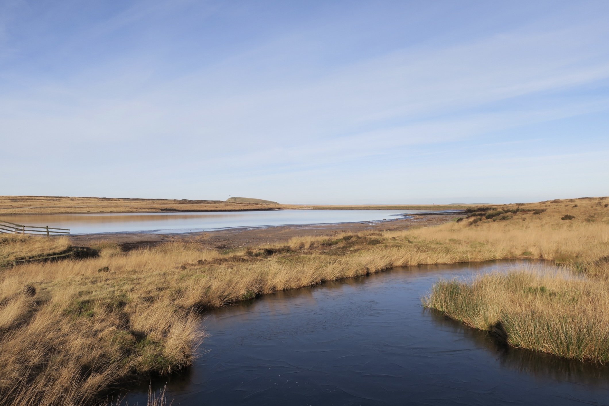
At Black Moss reservoir, we hunkered down from the cold and brewed up. It was a stunning lunch spot but, with the shorter winter days, there was no time to linger.
Onto the old Pennine Way
We peeled off the current Pennine Way route at Black Moss reservoir to follow the old route back uphill to the A635.
We expected difficult walking, and possibly challenging navigation. But, after an initial short section on a muddy but defined path we came across flagstones.
We tentatively followed them, double checking our location on the map to make sure the didn’t take us off on a tangent into a different valley!

Thankfully, the flagstones led straight to our planned crossing point over the A635.
But the other side of the A635 was a completely different story!
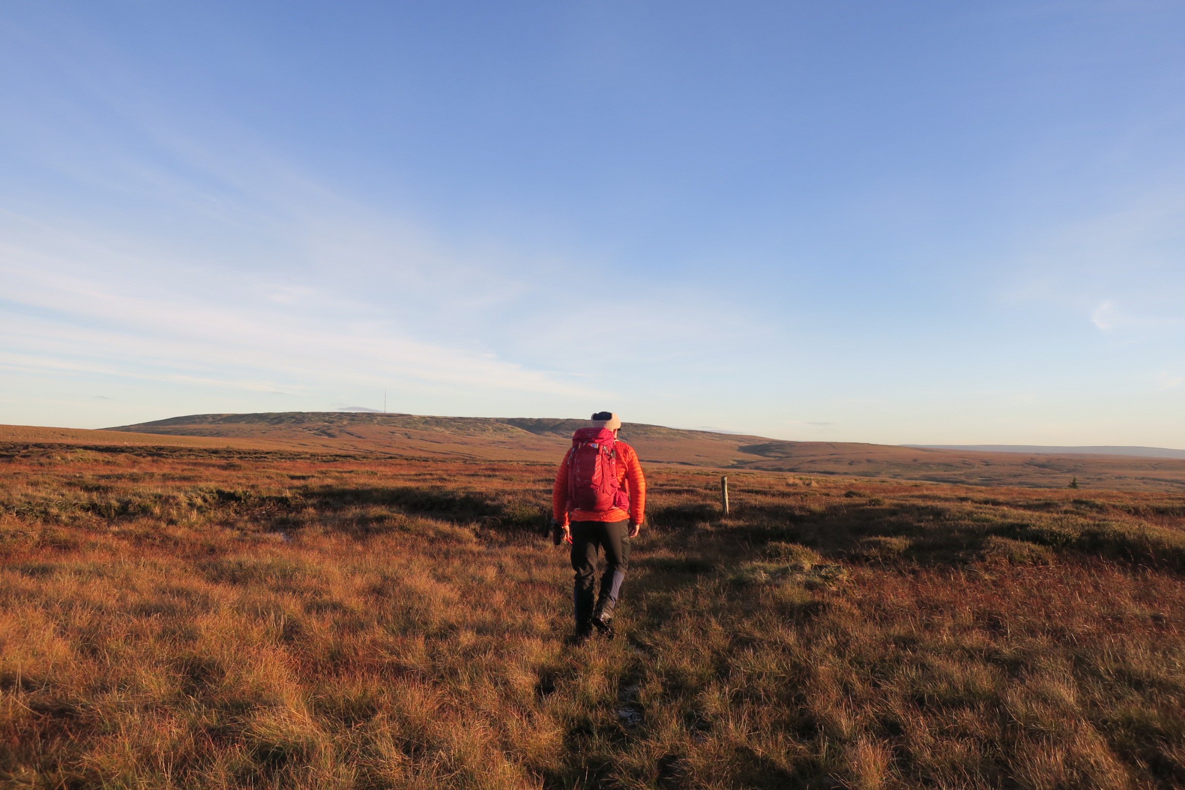
Challenging walking to Black Hill summit
First up we needed to find the start of the path. A friendly walker pointed us to the only obvious place, with a warning that it would be challenging to follow.
He was right!
With no clear path, we had to trust our instincts, read the map, and keep a check on our direction.
We went up and down peat hags.
We had to watch our footing as the thick heather covered up holes.
The icy conditions hadn’t quite frozen the bogs, so we had to read the terrain to avoid the worst of them.
And, we had to use the Holme Moss mast as our navigation anchor (it was right behind Black Hill summit) as we wove our way through the boggy moorland.
I’ve since read route descriptions of this section and am not surprised to see mentions of challenging, unclear, and remote, exposed moorland.
What does surprise me is that this was the original Pennine Way. Crikey, it must have been soul destroying!
The old notorious bogs of Black Hill
I remember planning to walk the first 6 days of the Pennine Way in the early 1990’s. The descriptions of Black Hill horrified me - tales of people stuck in the quagmire near the summit. I was almost relieved when we abandoned our attempt at Crowden after only one day.
Cicerone have an interesting article about the Pennine Way’s notorious bogs. This is what it says about Black Hill:
“What was once a 2m (6ft) wide path on Black Hill had increased to 22m (71ft) across.”
My fears back then were justified!
Thankfully, Moors for the Future have done lots of regeneration work on Black Hill. The current Pennine Way now follows a flagged path over the summit and the vegetation has grown back.
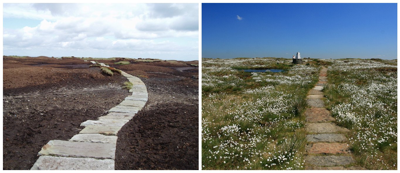
Before and after images of Black Hill
Approaching the summit with fading daylight
Back on our route, we eventually began seeing the odd path marker posts. Nothing regular enough to follow but they gave us some comfort that we were on the right track.
And nature gave us a treat too.
A mountain hare, resplendent in its white winter coat, ran between the two of us. It all happened too quickly for either of us to grab a picture. But the experience was enough. These shy creatures are rarely seen - but occasionally, you come across one hunkered down in the distance. I’d never seen one so close and it’s a memory I’ll treasure.
By now, the sun was beginning to set, so we quickened our pace. I wanted to be off the challenging moorland and safely at the summit trig before darkness fell.
Once we crossed the fords and began climbing more steeply uphill, Holme Moss disappeared. But, thankfully, the path had finally revealed itself. Our navigation was spot on and we emerged right at the summit trig post.
It had been a tough section of walking, especially with the light fading, so we decided get the stove out and enjoy a summit sunset.

Black Hill summit at sunset
One of my favourite summit experiences
It was freezing cold but an incredible experience.
And amazingly busy!
The weekend had brought out teams of runners training for the Montane Winter Spine Race. We had an enjoyable time chatting with runners who still had several more miles to tackle in the darkness.
But finally, the frigid wind galvanised us to leave.
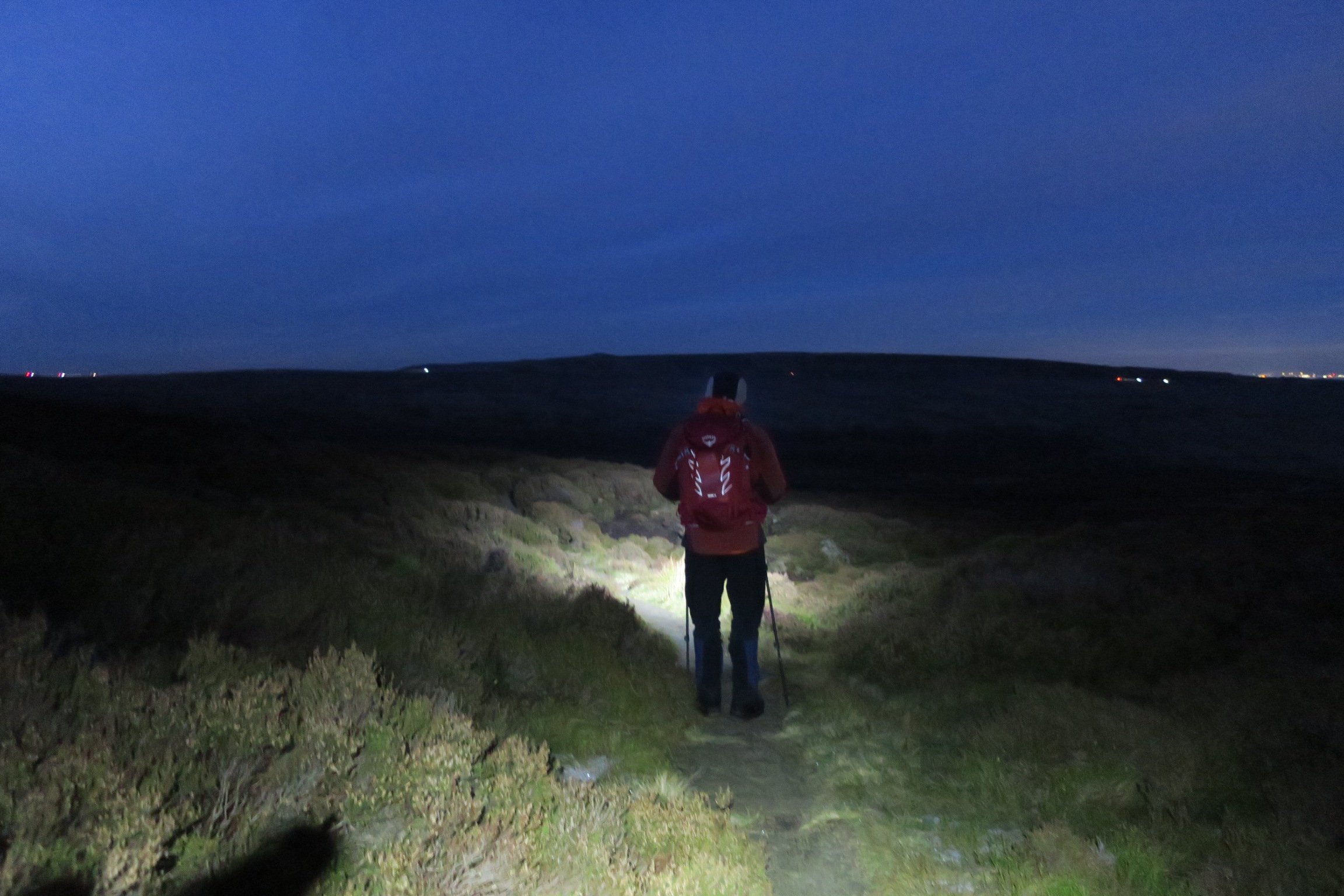
With head torches and extra gloves donned, we set off down the well-marked path of the current Pennine Way. As we looked out into the darkness, we could see the twinkling lights of Holmfirth and surrounding villages.
The last section of the walk was on stone flags, the only challenge being the icy conditions. More than once, I wished I’d worn my microspikes!

Walking off Black Hill summit on the current Pennine Way path
Dean Clough river crossing
The last challenge on this walk is a river crossing across Dean Clough.
It’s ok in normal conditions but can be difficult or impassable after heavy rain. The detour is signed before you get there, heading down in the direction of Holme village before turning back across the moor. But it does add extra miles, so be aware of that if you decide to do this walk in adverse weather.
We usually like to set out early on our walks - sometimes to see the sunrise - but our late start this time meant having a totally different experience.
I realised while watching the sunset on Black Hill summit that my blog post 28 mini adventures in winter includes a hill top sunset. I’ve seen many sunsets while out adventuring but think that was my first high summit sunset.
Here’s to more adventure this winter!
Useful information:
Important note: This is a challenging walk across open moorland, and only recommended for experienced walkers. Even in good visibility, it needs careful navigation skills with a map and compass.
Distance: 9.5 miles
Time: 6 hours
Parking: Free of charge (Grid Reference SE 076 072)
Summit trig: Black Hill (582m)
Refreshments: Occasional snack van (Snoopy’s) on the A635 Holmfirth to Greenfield road at the junction with Wessenden Head Road. Otherwise, Meltham or Holmfirth for shops, pubs, and cafes.
Toilets: None on route
Route: Grab my free GPX download of the route on Outdooractive but please remember that you will need to navigate part of it with a map and compass.
Map: OS Explorer OL1 Dark Peak Area

You may also be interested in reading:
Walk: Wessenden and West Nab (8.5 mile walk via Deer Hill Reservoir and Meltham)
Circular walk from Holme: wet and wild! (5 mile walk from Holme village)
What are the Peak District Ethels?
ENJOYED THIS POST? HERE’S HOW YOU CAN SUPPORT MORE CONTENT…
I’m an outdoor enthusiast, just like you, looking to read about fun and inspiring adventures. I write from my personal experience and ideally want to keep this website ad-free (who likes annoying pop-up ads getting in the way). But web hosting and creating new content costs money, and means a fair bit of unpaid work.
If you’ve been inspired, grabbed a GPX download, or found something helpful, you can support by buying me a cuppa via my Ko-Fi account. Thank you if you can 🫶
Get new adventures sent directly to your inbox. Emails usually go out every other week.
SIGN UP TO MY NEWSLETTER
Outdoor-Girl is run by Jacquie Budd, an outdoor adventure writer and marketing content writer for brands that care about their impact on people and the planet.