Black Hill, Peak District National Park
-
If you click a link with an * and buy from a company’s website, I may receive a small payment. This helps fund the Outdoor Girl site and keeps it free to use with no annoying pop up adverts.
But there are a couple of crucial things you need to know about this:
It never impacts my content or recommendations – if I include something, I genuinely think will be helpful
There is no extra cost to you when buying via one of these links
For a more detailed explanation, see my policy on affiliate links, including Amazon Associate links.
For transparency, you can also find duplicate links below that don’t help fund the Outdoor Girl website.

Black Hill summit
"Nothing can grow in this acid waste. There is no root-hold in this sea of ooze. In the flutings and ripplings of the surface of the dunes caused by the action of rain and wind, a certain strange beauty, a patterned sculpturing beyond the skill of man, must, however, be conceded. But it is a frightening place in bad weather, a dangerous place after heavy rain. It is not a place to visit unaccompanied."
These words were written by the famous guidebook author, Alfred Wainwright, in his Pennine Way Companion, 1968. He was talking about Black Hill (582m), usually tackled on the second day of a south to north attempt of the Pennine Way.
Black Hill, a notorious reputation
Back in the 1990’s, I decided to walk the first week of The Pennine Way with friends. Our plan was to start in Edale and finish six days later with a stay at my parents’ house in Malham.
Armed with our Pennine Way guidebook, we researched the routes and campsites for each day. But the warnings of Black Hill on the second day freaked me out. It was described as a place with deep, black peat bogs where walkers often became stuck.
The advice was to avoid the summit trig at all costs in bad weather. I planned to do exactly that, regardless of conditions! I’ve since read reports of the path around Black Hill summit in those days extending to 70-100ft wide as people attempted to walk around the bogs.
Our first day of the Pennine Way took us over Kinder Scout, Featherbed Moss, and Bleaklow. All are high moorland areas, and were riddled with peat bogs. I’m talking about a time well before the path was improved with stone flags.
I distinctly remember the peat groughs on Featherbed Moss with their energy sapping ups and downs. I walked around the worst of the bogs but one caught me, pulling me into thigh-high foul smelling water. My companions had to rescue me, laughing as I panicked, remembering stories of walkers meeting their death in deep peat bogs.
We walked 18 miles that first day and, carrying heavy packs laden with camping gear, realised we’d bitten off more than we could chew. It was with some relief that our attempt ended before I had to tackle the notorious bogs of Black Hill.
About Black Hill
Black Hill is in the far north of the Peak District National Park. It’s the third highest hill in the National Park (Kinder Scout and Bleaklow are higher), and the highest point in West Yorkshire. That said, it actually fell within Cheshire before the local government reforms in 1974.
The summit is one of the Peak District Ethels and classed as a Marilyn (a hill in Great Britain or Ireland with a relative height of at least 150m)
Black Hill summit is also known as Soldier’s Lump, a reference to the 18th century Royal Engineer surveyors who used it as a triangulation point. It’s said that the support timbers for the theodolite used in the original Ordnance Survey could still be see there many years later.
The trig pillar now sits on an elevated platform built from stone. I’ve read one account that talks about how it allowed for the depth of the peat bogs around it, another about how the peat has worn away over the years. Maybe both, or neither are true 🤷♀️
150 years of air-borne industrial pollution and wild fires ate away at the moorland vegetation on Black Hill, leaving bare, black peat. Heavy rain washed away the peat, and droughts dried it to dust, the wind blowing it off the fell.
But, in 2003, conservation work began, regenerating the moorland.
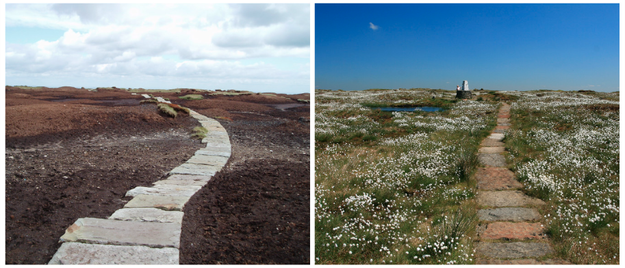
Black Hill in 2003 and 2011
Walking to Black Hill summit
In February 2018, I was finally persuaded to walk up Black Hill for the first time.
It was a cold, icy, snowy day so I figured any bare peat would be frozen solid. In hindsight, there was no need to worry because the regeneration work had transformed it into Green Hill 😂
But it’s fearsome reputation, built up all those years ago, still lingered. So it was with a little trepidation that I set off from Snoopy’s Snack van on the A635 to follow the Pennine Way on a flagged stone path.
Far from being a black quagmire, we walked on a hard-packed surface. As we approached the summit, the weather became foggier but we continued following well-worn tracks along the snowy path.
Then, the trig point came into view. I’d finally made it to Black Hill summit and, in the process, fallen in love with the notorious hill.
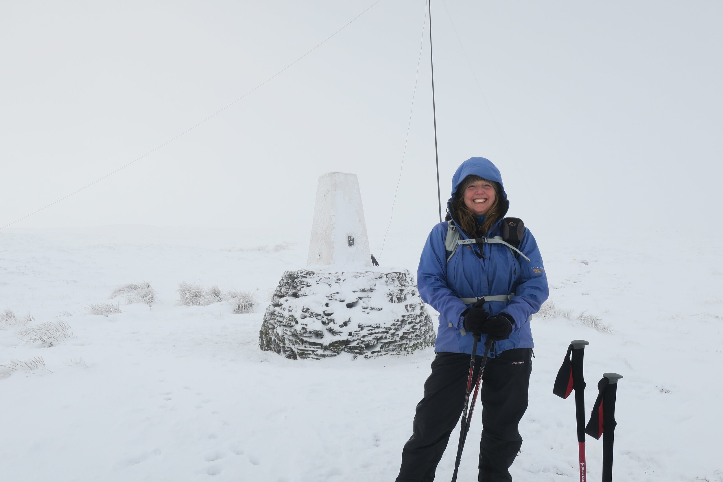
First time on Black Hill summit
Black Hill is now one of my favourite Peak District summits
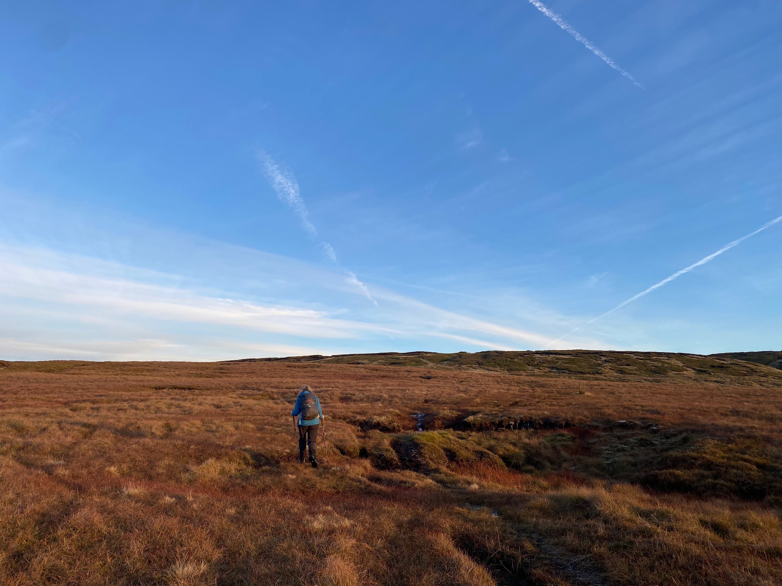
Since that day, I’ve been back to Black Hill summit countless times. In the depths of winter. The height of summer. At sunset. And from every official direction.
The two most obvious routes to the summit are on the flagged Pennine Way path (walking from either the south or north).
There’s also the old Pennine Way route from the summit to the A635. It’s not one I’d recommend unless you’re an experienced navigator and happy to cross desolate boggy peat moorland.
From Crowden, I’ve walked a circular route to the summit. Climbing up via Westend Moss and White Low, then returning on the Pennine Way, passing Laddow Rocks and near to Black Chew Head summit.
Recently, we ticked off the last direction, parking at Holme Moss summit and walking on a circular route across the moors.

Map of main paths on Black Hill summit
If you’re interested in walking to Black Hill summit, this link from Komoot gives you a starting point for some of the routes people take. You can also find many more via a quick Google search.
Why I love Black Hill so much
A friend, one of the original group of Pennine Way walkers back in the 90’s, knew how much I feared Black Hill and recently asked why I now love it so much.
I struggled to articulate my answer.
⛰️ Maybe it’s because of it’s once fearsome and notorious reputation, now lush with green vegetation.
⛰️ Perhaps it’s because one summer, I finally learned to appreciate the high moorland of the Dark Peak while researching and updating walks for AA 50 Walks in the Peak District >> See on Amazon *
⛰️ It could even be related to the pandemic, when we spent weeks exploring the desolate moorland on our doorstep, and I realised there was more to it than meets the eye.
⛰️ A walk up Black Hill also has stunning views and, whilst popular, it’s far enough away from the honeypots of the Peak District towns and villages to be a little quieter.
But sshhh 🤫 don’t tell everyone.

You may also be interested in reading:
Walk: Wessenden and Black Hill on the old and new Pennine Way routes
Important note: This is a challenging walk across open moorland, and only recommended for experienced walkers. Even in good visibility, it needs careful navigation skills with a map and compass.
Walk: Wessenden and West Nab from Snoopy’s snack van
What are the Peak District Ethels?
ENJOYED THIS POST? HERE’S HOW YOU CAN SUPPORT MORE CONTENT…
I’m an outdoor enthusiast, just like you, looking to read about fun and inspiring adventures. I write from my personal experience and ideally want to keep this website ad-free (who likes annoying pop-up ads getting in the way). But web hosting and creating new content costs money, and means a fair bit of unpaid work.
If you’ve been inspired, grabbed a GPX download, or found something helpful, you can support by buying me a cuppa via my Ko-Fi account. Thank you if you can 🫶
Get new adventures sent directly to your inbox. Emails usually go out every other week.
SIGN UP TO MY NEWSLETTER
Outdoor-Girl is run by Jacquie Budd, an outdoor adventure writer, and marketing content writer for brands that care about their impact on people and the planet.
What the * means above
If a link has an * by it, that means it’s an affiliated link and therefore helps the Outdoor Girl website stay free to use as it’s tracked to me. If you go through it, it can sometimes result in a payment to me.
You shouldn’t notice a difference, and there will be no extra cost to you. Importantly, the content I write is NEVER impacted by these links. For more details, please read my policy on affiliate links, including Amazon Affiliate links.
Please find below any duplicate links of the * links above for the sake of transparency, but note this version does not help the Outdoor Girl website:
>> AA 50 Walks in the Peak District from Amazon